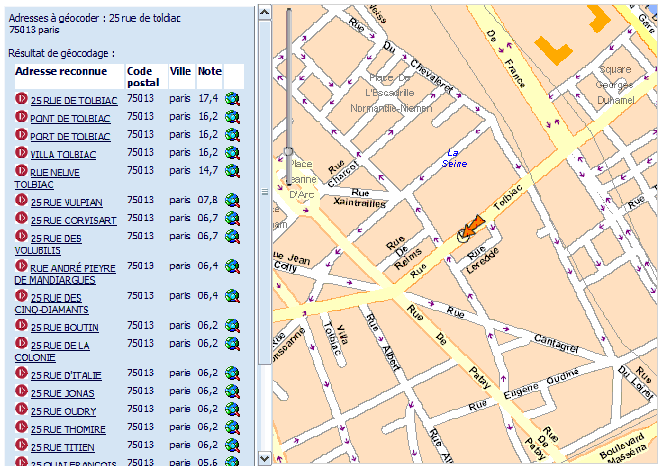
The application displays an address recognition tool.
For this, as a function of an address in the form (street number and street name, town, post code), a list of the nearest addresses found is suggested (this might be just one, if there are no errors present) along with their geographic locations.
The pop-up URL is: http://<serveur>/callcenter/Ext/geocode.do
The pop-up is called by the test page present at the address:
http://<serveur>/callcenter/Ext/geocodetest.do
The layer displayed in the map is configured in the popup.geographics.map.layer server parameter
The variables below must be sent to the pop-up via the POST method;
urlPost: URL receiving the geocoding results
userData: no matter what the data item consists of, it will be submitted without any modification to the results reception form. This data enables the master application to register a context, that could be useful for the return.
xmlData: the data to geocode in xml. The format is that of a SOAP geocoding query.
Example:
<?xml version="1.0" encoding="UTF-8" ?>
       <gc:GeocodeRequest xmlns:gc="http://geoconcept.com/gc/schemas">
          <gc:Address>
             <gc:CountryCode>fr</gc:CountryCode>
             <gc:City>Paris</gc:City>
             <gc:PostalCode>75013</gc:PostalCode>
             <gc:AddressLine>25 rue de Toldiac</gc:AddressLine>
          </gc:Address>
       </gc:GeocodeRequest>
The choice of a user is returned via a POST query containing the following parameters:
userData: the user data passed previously
address: the address recognised in practise (note: does not include the number if the number was not present in the geocoding database)
city: the town recognised.
postalCode: the recognised Post code
x: the X position (in the projection configured in the parameter server, or in longitude if a WGS84 projection has been requested)
y: Y position (idem)


